The first row is for desktop, and second row is for Tab and Mobile. You can right click on this text and use Navigator for easy editing. This text message is hidden on all screens using Advanced/responsive tab on left.
TRAINING - Drones
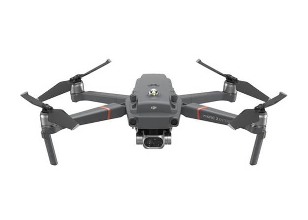
Certification & Licensing of ADVANCED DRONE PILOTS (Remotely Piloted Aircraft Systems)
PSC Ground School includes a comprehensive review of the rules and regulations governing the operation of RPAS in Canada, as well as everything that RPAS operators should know prior to piloting an aircraft or applying for a Special Flight Operations Certificate (SFOC).
Course Outline content covers the mandatory Transport Canada learning outcomes described in TP 15263: Knowledge Requirements for Pilots of Unmanned Air Vehicle Systems (UAV) 25 kg or Less, Operating within Visual Line of Sight. The course will focus on the following learning outcomes:
Air Laws, rules and regulations,
RPAS components airframes and systems
Aerodynamics and Theory of Flight
Meteorology
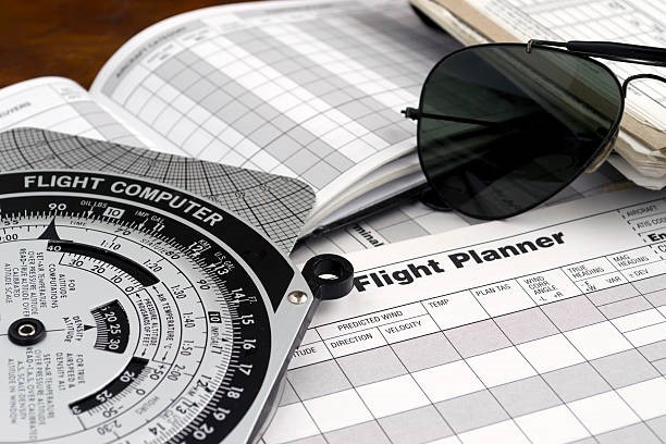
Flight planning
Navigation
Human Factors,
Flight & Radio Operations
At the end of the ground school a Transport Canada on- line exam is given.
Week 2: Flight School
This course is designed to build a student’s basic piloting skills and safe operating practices, to obtain a Transport Canada Advanced RPAS license. The course content covers:
Proper handling and set up of RPAS
How to handle batteries
Safe handling when powering RPAS
Pre-flight inspection
Complete Site Survey
Develop Flight Plan
How to use Checklists
How to use ARMS software
Set RTH Altitude
Ensure Mandatory documents
Ensure Emergency Equipment available
Understand low battery warnings
Demonstrate Flight Termination Procedures
Take off and land procedures
Learn Advanced operational maneuvers
Utilize auto flight procedures
Learn the controls
At the end of the course students will be given a Transport Canada on-line exam and a flight review done by a Transport Canada Reviewer
Module 2 – Advanced RPAS (Drone) Payload Training – Mapping & Getting up Grids – 1 week
This course is designed to help better understand how drones are being used in mapping and land surveying today. It provide some pointers about the mapping software out there, and to generally get you started. Drones are helping people to map large areas in a quick, cost-effective manner and to provide hard data that helps expedite workflows in a variety of commercial settings.
Drone mapping creates the capacity for Community Leadership and Administration to:
• Intro to mapping and modeling • Aerial Photogrammetry • 2D map data • Collecting 2D map data • 3D modeling • Collecting 3D map modeling • Using the map engine • Analyzing data • Map accuracy • Ground control points • Using ground control points • exporting data to app market
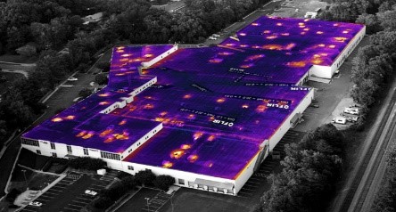
Module 3 – RPAS Thermal and Night Flying – 1 week Thermal cameras let people see what their eyes can not: invisible heat radiation emitted or reflected by all objects, regardless of lighting conditions. Different objects give off thermal energy differently, based on various factors, such as what it is made of and its surface condition.
Flying at night requires some understanding and basic flying skills. The course content covers:
• Setting up grids and basic mapping • Safe night operations • Pre- flight inspections • Developing a night-time survey and flight plan • Understanding Thermal Camera operations • Learn all controls of extra payload
At the end of the course each pilot will be given a flight review done by a Transport Canada Reviewer.